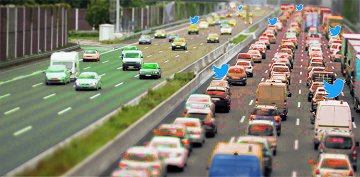
Aktuelle Verkehrsinformationen sind die Voraussetzung für Navigations-Lösungen, um die beste Route und Fahrzeit zu bestimmen. Es gibt jedoch keine frei verfügbaren Verkehrsinformationen auf weltweiter- und Bundesebene. „SocialMedia2Traffic nutzt frei verfügbare Daten aus sozialen Medien wie zum Beispiel Twitter-Nachrichten“, sagt Prof. … Read More
Deutsch
GeoNet.MRN at Smart City Expo World Congress Barcelona 2019
Last week was the Smart City Expo World Congress 2019 took place in Barcelona. Our region geoinformation network GeoNet.MRN was there with a booth presenting the members of GeoNet.MRN, among others the GIScience Research Group / HeiGIT at Heidelberg University. … Read More

New ORS Jupyter example about Fleet Scheduling for Disaster Response with ORS and VROOM
Routing optimization in a humanitarian context Routing optimization generally solves the Vehicle Routing Problem (a simple example being the more widely known Traveling Salesman Problem). A more complex example would be the distribution of goods by a fleet of … Read More

Solve routing optimization with VROOM + openrouteservice
The most optimal route through Germany’s 15 biggest citys. It’s the shortest route of exactly 43.589.145.600 different alterations. In a Vehicle Routing Problem (VRP, an example is the Traveling Salesman Problem), we are concerned with finding optimal routes for a … Read More