Last week, GIScience Heidelberg successfully held two collaborative workshops about OpenStreetMap (OSM) at the Department of Earth Observation in Jena. Dr. Chistian Thiel and his team from the University of Jena kindly organized the event. Three members of the GIScience … Read More
Blog
Exponat aus Heidelberg bietet Training für KI-Algorithmen auf der MS Wissenschaft
Mitmach-Exponate geben auf der MS Wissenschaft in Heidelberg vom 28. August bis 1. September Einblicke in die Entwicklung und Anwendung Künstlicher Intelligenz (KI). Mit auf dem zu einer schwimmenden Ausstellung umgebauten ehemalige Kohlefrachter ist auch ein Exponat des Heidelberg Institute … Read More
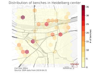
meinGrün @roadto_festival: What OSM tells us about urban green space features
Where is the next shaded bench to escape the burning heat? Where can I play soccer within the city and later on have a barbecue with my friends? All of these questions require information about features of urban green spaces. … Read More
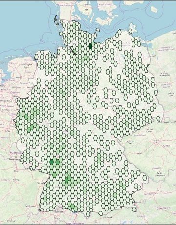
Farm Shops are ohsome
Welcome back to another ohsome blog post. Today, we will present the results of a recent analysis performed by our student assistant Jascha, who took a look at the distribution and development of farm shops (in German: Hofläden) at different … Read More
HeiGIT at AGIT conference 2019 in Salzburg- The spatial view
This week, the annual AGIT conference is again organised in Salzburg. The conference has since more than 30 years successfully gathered representatives of academia, applied research and economy to present latest projects, to share ideas and to develop new approaches. … Read More
Open Positions GIS at German Red Cross – Cooperation with HeiGIT
Das Rote Kreuz Generalsekretariat Berlin schreibt aktuell zwei interessante Vollzeitstellen aus (Standort Berlin). Eine davon – als Fachreferent Geoinformatik – ist direkt auf die konkrete Zusammenarbeit mit dem Heidelberg Institute for Geoinformation Technology (HeiGIT gGmbH) an der Universität Heidelberg ausgerichtet. … Read More
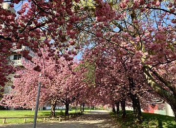
Do you need a shady route because it is too hot?
IT IS HOT! So you are looking for a more shady pedestrian route through the urban jungle? You might then prefer some routes that go through public green spaces with trees and bushes. Thank goodness we are working already on … Read More
The potential of Open Geospatial Data to address the Sustainable Development Goals- Geospatial World Magazine Article on how HOT and HeiGIT are supporting current approaches
Geospatial data is key for empowering citizens around the globe and to achieve the SDGs— if geodata is made openly available and easy to be put to use. The Humanitarian OpenStreetMap Team (HOT) is in this regard coordinating and supporting … Read More
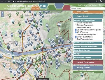
Support the global OSM Climate Protection Map at WorldEnvironmentDay
Today, June 5 is the #WorldEnvironmentDay. World Environment Day is the United Nations day for encouraging worldwide awareness and action to protect our #environment. Above all, World Environment Day is the “people’s day” for doing something to take care of … Read More
ISCRAM 2019 in Valencia- Towards closer exchange in crisis management between practitioners, stakeholders and researchers
The 16th ISCRAM conference took place in the city of Valencia (Spain). It succeeded again to gather an international audience of researchers that shared their work all around crisis management. As ISCRAM is mainly interested in the support and intersection … Read More
Successfull PhD Defence by Clemens Jacobs on Plausibility Estimation of Citizen Science Observations for Biodiversity
Last week Dr. Clemens Jacobs successfully defended his PhD about methods for assessing the data quality of citizen science observations of organisms. Congratulations, well done!!! We wish all the very best for the future! The research aimed at using geographic … Read More
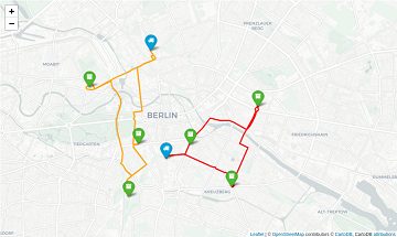
OpenRouteService with waypoint optimization
As promised earlier this year, we’re very happy to finally announce the unveiling of our new route optimization endpoint! We deployed an instance of the popular Vroom open-source engine, which is capable of solving complex Vehicle Routing Problems (VRP) in … Read More
Disaster Risk Reduction, OpenStreetMap and Missing Maps at Global Platform 2019
Global Platform 2019 in Geneva Creating maps helps humanity. Drawing maps together with communities is crucial for effective risk reduction interventions, ensuring no one is left behind. The progress of the implementation of the targets set by the Sendai … Read More
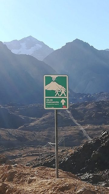
Teaching at the Heidelberg Center for Latin America in Santiago de Chile
This year, Sabrina Marx and Martin Hilljegerdes were teaching the block course “GIS 2” at the Heidelberg Center for Latin America (HCLA) in Santiago de Chile. The course is part of the international Master program “Governance of Risks and Resources”, … Read More
HeiGIT/ GIScience at ISCRAM conference in Valencia
19th-22nd of May, the 16th Information Systems for Crisis Response and Management (ISCRAM) conference is taking place in Valencia. Likewise to previous years, the GIScience Research Group/HeiGIT are taking part and supporting with several contributions. Martin Hilljegerdes will present a … Read More
Sonniges „meinGrün“ Konsortiumstreffen in Heidelberg
Letzte Woche fand das zweite große Konsortiumstreffen im Projekt „meinGrün“ in Heidelberg statt. Zusammen mit unseren Projektpartnern vom IÖR , DLR , ISB AG , dem Institut für Kartographie der TU Dresden , Terra Concordia (mundraub.org) und Urbanista haben wir … Read More
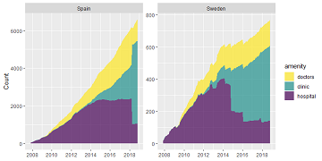
Exploring OSM history: the example of health related amenities
Introduction Exploring how OpenStreetMap data developed over time across different administrative units might reveal interesting insights into the self organizing approach of the OSM communities and can potentially be used to derive intrinsic data quality indicators. It might even be … Read More
Letzte Vorbereitungen: Start der MS Wissenschaft am 16. Mai 2019
Mitmach-Exponate direkt aus der Forschung geben in der Ausstellung auf der MS Wissenschaft 2019 Einblicke in die Entwicklung und Anwendung Künstlicher Intelligenzen (KI). Die MS Wissenschaft startet ihre Tour am 16. Mai 2019 in Berlin und besucht Ende August auch … Read More
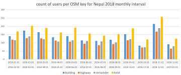
How to become ohsome part 5: Measuring numbers of users editing different OSM features
Besides dealing with a snake, making quality assessments, or generating comparable statistics, one needs to know how to handle the whole functionality provided by the ohsome API to really become ohsome. And to achieve exactly that, this blog presents the … Read More
HeiGIT/GIScience at Global Platform for Disaster Risk Reduction and Multi Hazard Early Warning Conference
Middle of May, Geneva becomes the gathering place for citizens, political leaders, government institutions, private sector, civil society, and scientific and technical institutions, that all jointly work towards a big objective – to manage disaster risk. In line with the … Read More
