Around 55 participants gathered in Malta for the 3rd International Workshop on Spatial Data Quality 2020 from 28th to 29th of January. Among national mapping agencies, software providers and standardization organizations, HeiGIT had the opportunity to present its ohsome – … Read More
English
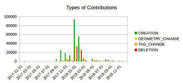
Mapping Rohingya Refugee Camps in Bangladesh – An Analysis Using the OSHDB API
Humanitarian mapping activations show increasing numbers of contribution. This blog post illustrates the specific potential of the OSHDB API [1] for detailed analyses of such activations by means of a case study. The examined area is Cox’s Bazar in Southeast … Read More
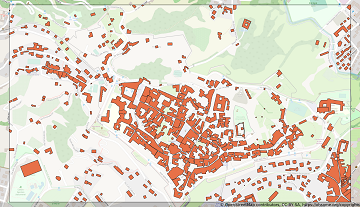
Becoming ohsome is simple: Adding support of simple feature types to the ohsome API
It’s been a while, since we have published the last blog post about the awesome ohsome platform, but don’t worry, there’s always something happening of course in the spatial analytics team of HeiGIT. So here we are, back on track … Read More
Tools for Disaster Risk Reduction by HeiGIT – Celebrating the International Day for Disaster Risk Reduction
Today we celebrate the International Day for #DisasterRiskReduction. HeiGIT offers a growing set of tools and services that support humanitarian aid during and before disasters. Examples include work in the context of the Missing Maps initiative, like conceptualising and extending … Read More
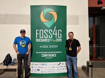
Recap of HeiGIT @ FOSS4G 2019
First of all, thanks to everybody who attended our ohsome lab at last weeks FOSS4G in Bucharest. Even though there were eleven (!) tracks running in parallel, and our lab was not in the same location as the program track, … Read More
HeiGIT presents ohsome Lab at FOSS4G 2019 Bucharest
This week, the annual conference FOSS4G (Free and Open Source Software for Geospatial) is taking place in Bucharest, Romania. The conference is organized by The Open Source Geospatial Foundation (OSGeo) and attracts over 1000 professionals from industry and academia each … Read More
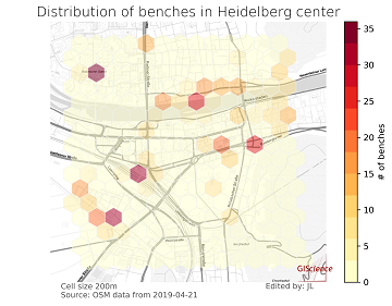
meinGrün @roadto_festival: What OSM tells us about urban green space features
Where is the next shaded bench to escape the burning heat? Where can I play soccer within the city and later on have a barbecue with my friends? All of these questions require information about features of urban green spaces. … Read More
Farm Shops are ohsome
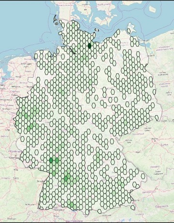
Welcome back to another ohsome blog post. Today, we will present the results of a recent analysis performed by our student assistant Jascha, who took a look at the distribution and development of farm shops (in German: Hofläden) at different … Read More
Successfull PhD Defence by Clemens Jacobs on Plausibility Estimation of Citizen Science Observations for Biodiversity
Last week Dr. Clemens Jacobs successfully defended his PhD about methods for assessing the data quality of citizen science observations of organisms. Congratulations, well done!!! We wish all the very best for the future! The research aimed at using geographic … Read More
Disaster Risk Reduction, OpenStreetMap and Missing Maps at Global Platform 2019
Global Platform 2019 in Geneva Creating maps helps humanity. Drawing maps together with communities is crucial for effective risk reduction interventions, ensuring no one is left behind. The progress of the implementation of the targets set by the Sendai … Read More
How to become ohsome part 5: Measuring numbers of users editing different OSM features
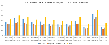
Besides dealing with a snake, making quality assessments, or generating comparable statistics, one needs to know how to handle the whole functionality provided by the ohsome API to really become ohsome. And to achieve exactly that, this blog presents the … Read More
OSHDB: a framework for spatio-temporal analysis of OpenStreetMap history data
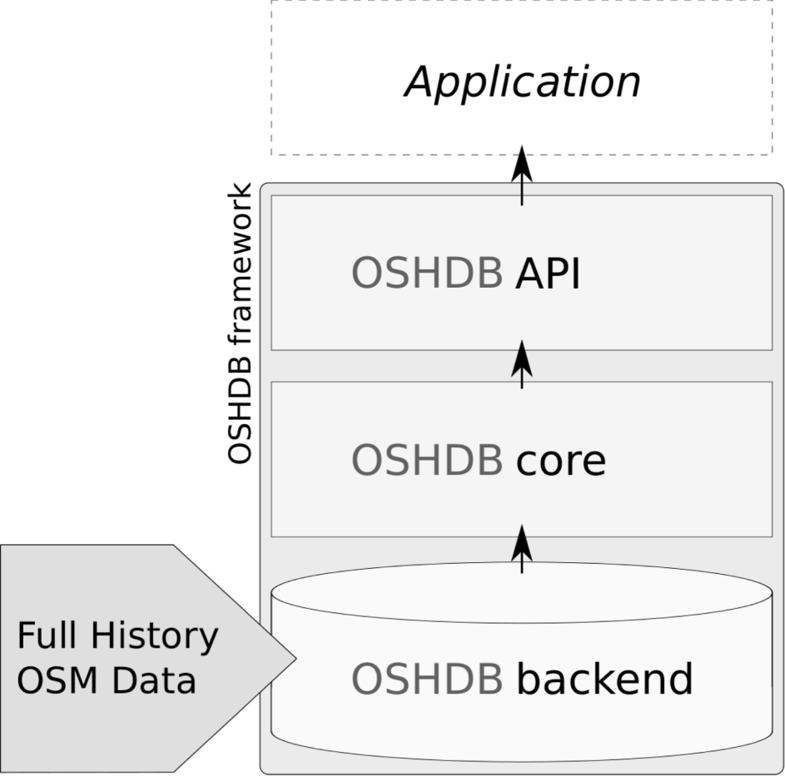
Earlier we published several blogposts introducing the ohsome platform and its parts (e.g. the ohsome API for example, which was often showcased here in the blog) and its backbone the OSHDB (very recently version 0.5 was published). A recent open … Read More
GIScience / HeiGIT at ICT for Development, Kampala – Usage and Analyses of OpenStreetMap for Development
The 11th Information Communications Technology for Development (ICT4D) Conference brings together hundreds of public, private and civil society organizations, eager to share practical insights on applying digital technology to development, humanitarian, and conservation challenges. Participants share how they are using … Read More
OpenStreetMap History Database – version 0.5
The OpenStreetMap History Database (OSHDB) is what powers most of the functionality of HeiGIT’s ohsome platform. The ohsome API for example, which was often showcased here in the blog, is built on top of the OSHDB. Just recently, an open … Read More
How to become ohsome part 4: handling a snake in a notebook on another planet
Welcome back to a new episode of how to become ohsome. Yes, you’ve read the heading correctly. We are really talking about a snake in a notebook on another planet. If you are familiar with one of the most used … Read More
Preview: Spatial Joins using the OpenStreetMap History Database OSHDB
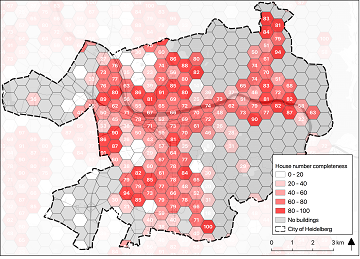
Max is two and loves spending Monday afternoons with his Dad at the playground. Finding a suitable playground however isn’t easy, since a few criteria must be met: there should be a bench and some trees nearby to get shelter … Read More
Global analyses are ohsome
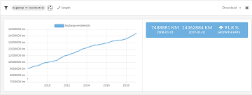
We, the Big Spatial Data Analytics Group at HeiGIT have ohsome news to share: From now on, you can send your requests to our global ohsome API instance. So far, we’ve had a public instance for Nepal and Germany, but … Read More
Plausible Parrots – HeiGIT’s OSHDB Supports Research in Citizen Science Data Quality
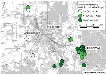
In the GIScience research group at Heidelberg University, a recent PhD research project by Clemens Jacobs has been looking into the data quality of citizen science observations of organisms. This research aims at using geographic context as an information source … Read More

HeiGIT and Humanitarian OpenStreetMap Team at the Geospatial World Forum 2019 in Amsterdam
Beginning of April, Amsterdam will become the gathering place for the global geospatial community. The Geospatial World Forum is organized for the 11th time and builds on previous successes that made it a leading event in sense of innovation, thematic … Read More
OpenStreetMap history explorer – ohsomeHeX published
The exploration of the history of OpenStreetMap data presents an important step to uncover semantic connections, regions of interest and their contiguity in time and space at varying scales. Therefore, the HeiGIT Big Spatial Data Analytics team presents a first … Read More
