Last week was the Smart City Expo World Congress 2019 took place in Barcelona. Our region geoinformation network GeoNet.MRN was there with a booth presenting the members of GeoNet.MRN, among others the GIScience Research Group / HeiGIT at Heidelberg University. … Read More
English
Marcel Reinmuth: Talk about internship at Humanitarian OpenStreetMap Team Uganda
GIScience HD/HeiGIT sind seit geraumer Zeit Partner des Humanitarian Open StreetMap Team (HOT) und arbeiten an gemeinsamen Projekten zur Verbesserung von Geoinformationstechnologien und der Verfügbarkeit von Geodaten (insb. OpenStreetMap) für humanitäre Einsätze, insbesondere im globalen Süden, z.B. über die Missing … Read More
Standortübergreifender Mapathon im Rahmen der Geography Awareness Week
im Rahmen der Geography Awareness Week laden die Geographie-Fachschaften der Standorte Göttingen, Hannover, Würzburg und Heidelberg und die disastermappers heidelberg herzlich zum standortübergreifenden Mapathon ein! An diesem Mapathon werden wir gemeinschaftlich mit Hilfe von OpenStreetMap und fernerkundlichen Methoden neue Kartendaten … Read More
Winner of the 2019 Climathon Heidelberg
Over the last few days, Heidelberg’s first climathon event took place at EMBL, which was part of the global Climathon. The event ran from 25th-27th October 2019 with a 24 hour hackathon taking place on the 26th-27th. During the 24 … Read More

Einladung zum Beta Test der meinGrün App
Beim Konsortialtreffen letzte Woche haben wir die erste Beta Version der meinGrün App fertiggestellt. Jetzt benötigen wir Grünflächen-Enthusiasten, die mit uns zusammen die App testen, um sie weiter zu verbessern. Diesen Samstag findet unser erstes Test-Event statt: WO: Volkshochschule Heidelberg … Read More
Tools for Disaster Risk Reduction by HeiGIT – Celebrating the International Day for Disaster Risk Reduction
Today we celebrate the International Day for #DisasterRiskReduction. HeiGIT offers a growing set of tools and services that support humanitarian aid during and before disasters. Examples include work in the context of the Missing Maps initiative, like conceptualising and extending … Read More
Brownbag Presentation by Jennings Anderson (University of Colorado Boulder) on OpenStreetMap data analysis
We cordially invite you to a Brownbag presentation by our Guest Researcher Dr. Jennings Anderson! When? Tuesday, 8/10/2019, 1-2.30 pm Where? Seminar room 15, INF 348 Jennings is a postdoctoral researcher at the University of Colorado Boulder exploring new approaches … Read More
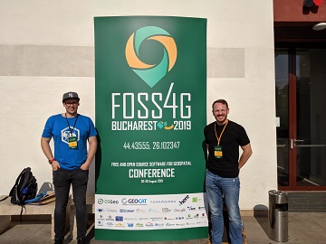
Recap of HeiGIT @ FOSS4G 2019
First of all, thanks to everybody who attended our ohsome lab at last weeks FOSS4G in Bucharest. Even though there were eleven (!) tracks running in parallel, and our lab was not in the same location as the program track, … Read More
HeiGIT presents ohsome Lab at FOSS4G 2019 Bucharest
This week, the annual conference FOSS4G (Free and Open Source Software for Geospatial) is taking place in Bucharest, Romania. The conference is organized by The Open Source Geospatial Foundation (OSGeo) and attracts over 1000 professionals from industry and academia each … Read More
OpenStreetMap (OSM) Workshop at the University of Jena
Last week, GIScience Heidelberg successfully held two collaborative workshops about OpenStreetMap (OSM) at the Department of Earth Observation in Jena. Dr. Chistian Thiel and his team from the University of Jena kindly organized the event. Three members of the GIScience … Read More
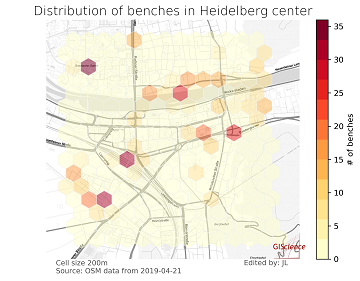
meinGrün @roadto_festival: What OSM tells us about urban green space features
Where is the next shaded bench to escape the burning heat? Where can I play soccer within the city and later on have a barbecue with my friends? All of these questions require information about features of urban green spaces. … Read More
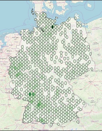
Farm Shops are ohsome
Welcome back to another ohsome blog post. Today, we will present the results of a recent analysis performed by our student assistant Jascha, who took a look at the distribution and development of farm shops (in German: Hofläden) at different … Read More
Open Positions GIS at German Red Cross – Cooperation with HeiGIT
Das Rote Kreuz Generalsekretariat Berlin schreibt aktuell zwei interessante Vollzeitstellen aus (Standort Berlin). Eine davon – als Fachreferent Geoinformatik – ist direkt auf die konkrete Zusammenarbeit mit dem Heidelberg Institute for Geoinformation Technology (HeiGIT gGmbH) an der Universität Heidelberg ausgerichtet. … Read More
Do you need a shady route because it is too hot?
IT IS HOT! So you are looking for a more shady pedestrian route through the urban jungle? You might then prefer some routes that go through public green spaces with trees and bushes. Thank goodness we are working already on … Read More
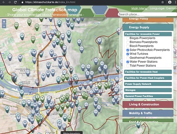
Support the global OSM Climate Protection Map at WorldEnvironmentDay
Today, June 5 is the #WorldEnvironmentDay. World Environment Day is the United Nations day for encouraging worldwide awareness and action to protect our #environment. Above all, World Environment Day is the “people’s day” for doing something to take care of … Read More
Successfull PhD Defence by Clemens Jacobs on Plausibility Estimation of Citizen Science Observations for Biodiversity
Last week Dr. Clemens Jacobs successfully defended his PhD about methods for assessing the data quality of citizen science observations of organisms. Congratulations, well done!!! We wish all the very best for the future! The research aimed at using geographic … Read More
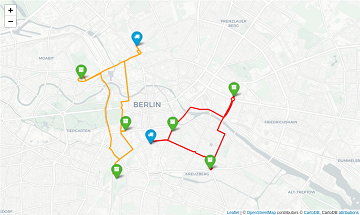
OpenRouteService with waypoint optimization
As promised earlier this year, we’re very happy to finally announce the unveiling of our new route optimization endpoint! We deployed an instance of the popular Vroom open-source engine, which is capable of solving complex Vehicle Routing Problems (VRP) in … Read More
Sonniges „meinGrün“ Konsortiumstreffen in Heidelberg
Letzte Woche fand das zweite große Konsortiumstreffen im Projekt „meinGrün“ in Heidelberg statt. Zusammen mit unseren Projektpartnern vom IÖR , DLR , ISB AG , dem Institut für Kartographie der TU Dresden , Terra Concordia (mundraub.org) und Urbanista haben wir … Read More
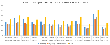
How to become ohsome part 5: Measuring numbers of users editing different OSM features
Besides dealing with a snake, making quality assessments, or generating comparable statistics, one needs to know how to handle the whole functionality provided by the ohsome API to really become ohsome. And to achieve exactly that, this blog presents the … Read More
meinGrün Umfrage: Wofür nutzen Sie städtische Grünflächen?
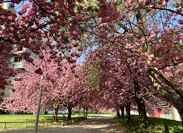
Alle Jahre wieder blühen die Kirschbäume vor unserem Institutsgebäude in voller Pracht und laden Passanten allen Alters ein zum Verweilen. Städtische Grünflächen wie diese leisten einen wichtigen Beitrag zur urbanen Lebensqualität, indem sie viele Funktionen wie Naturerfahrung, sozialen Austausch und … Read More
