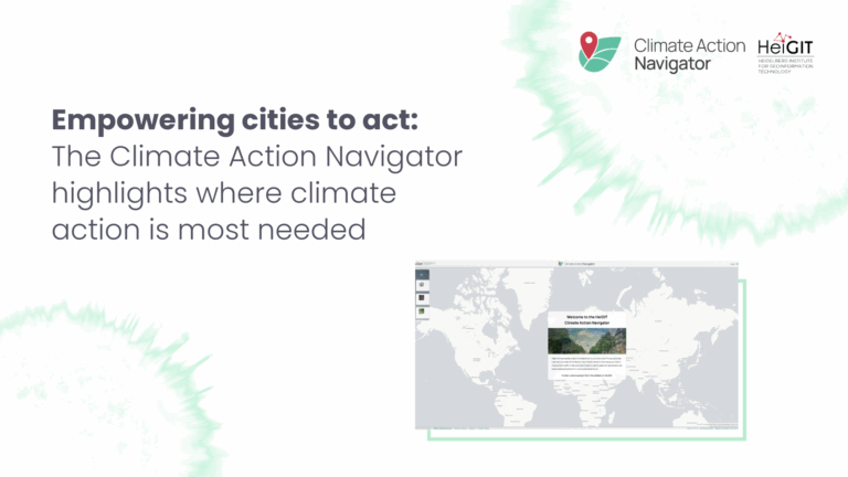
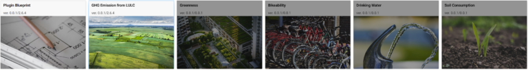
What does a climate-neutral, livable city look like – and what concrete actions can help us get there? The new Climate Action Navigator (CAN) from HeiGIT (Heidelberg Institute for Geoinformation…
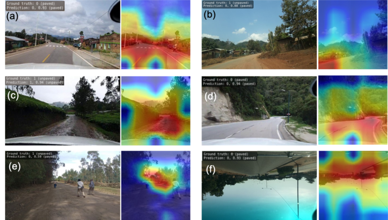
Researchers at HeiGIT (Heidelberg Institute for Geoinformation Technology) have publicly released a first of its kind planet-scale dataset on road surface type (paved or unpaved) using state-of-the-art GeoAI methods based on…
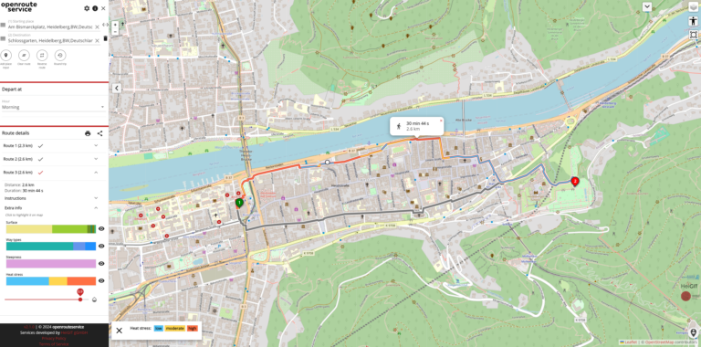
As summer temperatures soar, the health risks associated with heat stress become increasingly significant. This issue is particularly pronounced in urban areas such as Heidelberg and other cities, where dense…
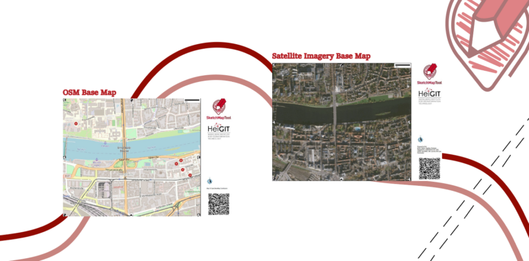
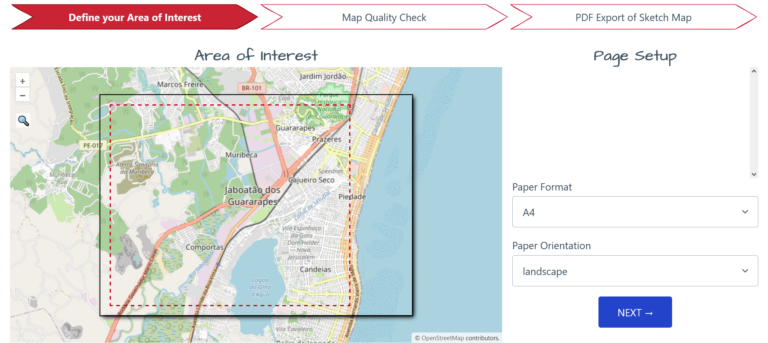
The HeiGIT gGmbH (Heidelberg Institute for Geoinformation Technology) team has just released a version 2.0 of the Sketch Map Tool, a low-tech solution for participatory sketch mapping through offline data…
HeiGIT is embarking on an initiative to address one of the most critical challenges of our time — climate change. We are proud to announce the commencement of the Climate…
The “Waterproofing Data” project has won the ESRC Celebrating Impact Prize 2023 in the category “Outstanding Societal Impact” for helping to protect residents of flood-prone areas in Brazil. In 2018,…
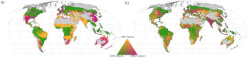
Re-arranging food production: How we could use the vegetation zones on our planet more efficiently Imagine we could almost double the amount of crops we grow on our planet, while…
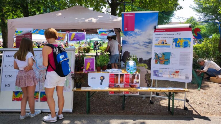
The transdisciplinary project HEAL involves citizens in the research process on heat stress in the city: The aim is to make everyday life easier for at-risk groups during heat waves….
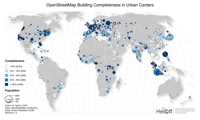
Benjamin Herfort and his colleagues Sven Lautenbach, João Porto de Albuquerque, Jennings Anderson and Alexander Zipf published an article in the renowned journal Nature Communications (Impact Factor 2023: 17.7). In…
Sketch Map Tool (SMT) – An easy-to-use way to create and digitalize paper maps for offline data collection in the field The HeiGIT (Heidelberg Institute for Geoinformation Technology) team recently…
During catastrophic events such as the recent Türkiye/Syria earthquake, the road infrastructure in the affected area is often widely interrupted and accessibility varies over time. In spite of this, it…
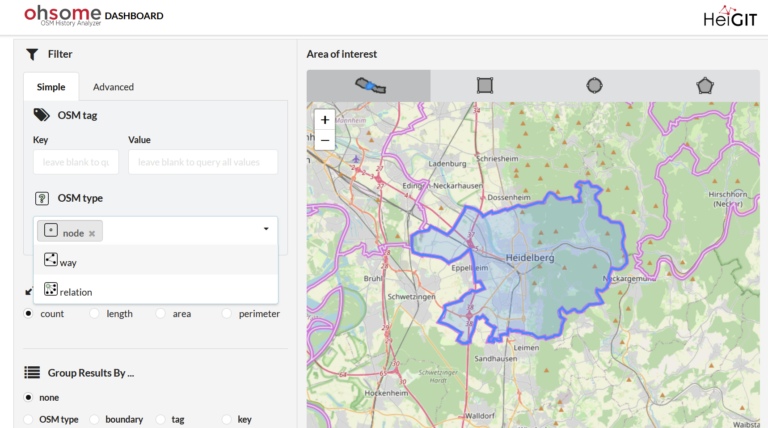
With the OSHDB Ver. 1.0, the Heidelberg Institute for Geoinformation Technology (HeiGIT) releases a professional software that enables analyzing and visualizing of OpenStreetMap data development via a simple dashboard. Heidelberg,…
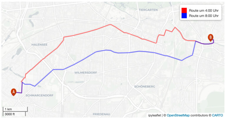
Geoinformatics researchers from Heidelberg are helping to improved the usability of geocoded information through the project “SocialMedia2Traffic”. Heidelberg 23rd of May, 2022. Navigation services require up-to-date traffic information in order…
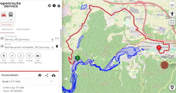
Underpasses, stairs, and high curbsides are a challenge for people with impaired mobility, but these can be circumnavigated using a customized route planner for increasing mobility by calculating routes with…
The impact of climate change is particularly strong in higher latitudes. The Arctic is currently warming up at a much higher pace than the global average. This leads to thawing…
Die Universität Heidelberg berichtet aktuell über impfzentrum.openrouteservice.org NEUER ROUTENPLANER ERMITTELT DEUTSCHLANDWEIT DIE SCHNELLSTE ROUTE ZUM NÄCHSTEN IMPFZENTRUM Wo kann ich mich gegen das Coronavirus impfen lassen und wie komme ich…