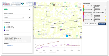
Erhalten Sie mit ohsomeHeX wertvolle Einblicke in die Qualität und den Entwicklungsprozess von OpenStreetMap-Daten! (see for english version here) Das HeiGIT Big Data Team freut sich zur Exploration der Veränderungen der globalen Daten in OpenStreetMap nun eine Version 1.0 von … Read More
Deutsch

OSMlanduse European Union validation effort EuroSDR conference 11/24/2020
During the EuroSDR workshop we will present our OSMlanduse product (earlier post) to the land use (LU) and land cover community (LC) and highlight class accuracies and a benchmark comparison towards existing national authoritative products. Accuracy estimated to be presented … Read More
Mapathons im Rahmen der OSM Geography Awareness Week – OSM GeoWeek
Kooperation ist in der Humanitären Hilfe oft der Schlüssel, um Menschen in Not schnell und effizient helfen zu können. Das gilt insbesondere beim Austausch von Informationen und Kartenmaterial. Besonders herausfordernd sind die Situationen für Humanitäre Organisationen in Gebieten, von denen … Read More
New paper published: Participatory Mapping and Visualization of Local Knowledge: An Example from Eberbach, Germany
Flooded parking area in Eberbach in January 2019 (Picture: C.Klonner) Worldwide, more and more people are affected by flooding. Local knowledge provides a valuable source of information for disaster risk reduction. We present an approach for visualizing and formalizing this … Read More
Regional Variations of Context-based Association Rules in OpenStreetMap
As a user‐generated map of the whole world, OpenStreetMap (OSM) provides valuable information about the natural and built environment. However, the spatial heterogeneity of the data due to cultural differences and the spatially varying mapping process makes the extraction of … Read More
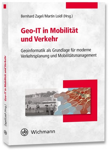
Optimal ans Ziel: Routing-Dienste auf Basis nutzergenerierter Geodaten
Ein neues Buch gibt in einem Buchkapitel einen Überblick der vielfältigen Aktivitäten von HeiGIT und GIScience im Bereich Routenplanung und Navigation. Neben Grundlagen (wie schnelle Routing-Algorithmen) zur Umsetzung werden vor allem diverse Anwendungsbeispiele für flexible Routing-Dienste in Spezialanwendungen vorgestellt. Hierzu … Read More
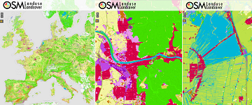
OSMlanduse wird auf Geonet.MRN Meetup zu Flächennutzung und Flächenmanagement vorgestellt: Donnerstag 29.10.2020, 16:30
Am am 29.10.20, 16:30 Uhr veranstaltet das Netzwerk Geoinformation der Metropolregion Rhein-Neckar GeoNet.MRN zum Thema: Flächennutzung und Flächenmanagement: Ein Geoinformation Meetup Teilnahme: Kostenlos und ohne Anmeldung mit Teams unter diesem Link. Themen des Meetups sind die Online-Beteiligung von Kommunen, Bürgern … Read More
“Open Data und die Sustainable Development Goals” geht in die zweite Runde
Liebe disastermappers-Freund*innen und Vorkämpfer*innen für freie Geoinformationen! Es ist wieder so weit: Unsere Veranstaltungsreihe “Open Data und die Sustainable Development Goals” geht in die zweite Runde! Nachdem wir uns im Sommersemester schon dem Thema Nachhaltige Entwicklung und deren Verknüpfung mit … Read More
GIScience/HeiGIT at GeOnG Conference 2020
Next week the biennial conference GeOnG will take place for the seventh time. On Monday and Tuesday 11/02-11/03 participants will join in over 30 live sessions around the topics of technology and information management in the humanitarian and development sector. … Read More
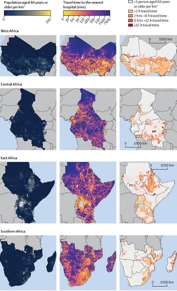
Mapping physical access to health care for older adults in sub-Saharan Africa and implications for the COVID-19 response: a cross-sectional analysis
New paper published on healthcare access in Sub-Saharan Africa It is almost a year since SARS-CoV-2 first emerged in China. The virus spread all over the world. Countries south of the Sahara did not receive much attention. Although outbreaks here … Read More
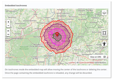
New embedded mode for OpenRouteService map client available
The new openrouteservice map client development is in the final phase and has now a new feature that allows to show routes, isochrones and other features from openrouteservice (ORS) integrated on other websites. This allows webmasters and editors to embed … Read More
Participate in the virtual Copernikus Hackathon 16-17-18 October! HeiGIT contributes with OSM based services
On October 16-18 there is the Copernicus Hackathon “Barcelona” – Integrating Copernicus services and state-of-the-art tools within Weather-induced emergency management HeiGIT is involved in the Copernicus Hackathon by providing free and open web-based services and APIs which leverage OpenStreetMap data … Read More
HeiGIT presentation at MSF GIS Week 2020
This Thursday, team members from HeiGIT will give a presentation at MSF’s Annual GIS Week. This is an internal event at MSF ( Médecins Sans Frontières (MSF) International, Doctors without Borders), which brings together all employees working on GIS and … Read More
OSMlanduse European Union validation effort
We launched a validation campaign of our new 10meter resolution OSMlanduse product for the member states of the European Union. Please contribute to the validation here. A technique where contributions are checked against each other is implemented to promote quality … Read More
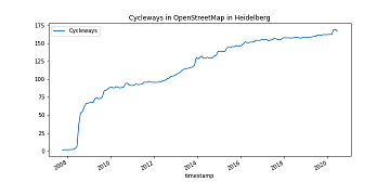
How to become ohsome part 8 – complex analysis with the magical filter parameter
It’s CITY CYCLING time – some of you may even be involved in your municipality – a good opportunity to have a look on the OpenStreetMap (OSM) cycling ways in our city Heidelberg. Welcome to part 8 of our how … Read More

Contiguous high resolution OSMlanduse map of the European Union by combining Copernicus data and OpenStreetMap
Find here a new update of the OSMlanduse.org map. By injecting known tags provided by OpenStreetMap (OSM) into a remote sensing feature space using deep learning, tags were predicted when absent thus creating a contiguous map – initially for the … Read More
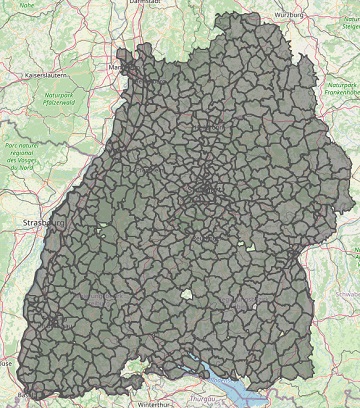
Improved Isochrone Calculation released in openrouteservice v6.3.0
With the release of openrouteservice v6.3.0 at HeiGIT, we are presenting a new and improved speed-up technique that makes it possible to calculate much larger isochrones than with the existing algorithm. An isochrone is an area on the map that … Read More
ohsome API v1.1 – changes and new functionalities
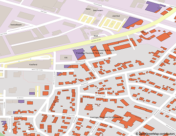
Recently we’ve had the first minor release 1.1 of the ohsome API, which brings several new features and upgrades. In the following lines we want to present to you the most important ones. Prior to 1.1, when you were requesting … Read More
Disy integriert openrouteservice in Cadenza
Das Karlsruher Softwareunternehmen Disy Informationssysteme GmbH stellt die neue Version der Data-Analytics-, Reporting- und GIS-Plattform “Cadenza” vor. Die Erweiterung der Analytics-Funktionalitäten mit der Bereitstellung einer integrierten Routingfunktion und der POI-Suche sind zwei der wesentlichen Neuerungen. Realisiert wurde das Routing in … Read More
Integration of Authoritative and Volunteered Geographic Information for updating Urban Mapping: Challenges and Potentials
A recently published paper provides a bibliometric review between integration of authoritative and volunteered geographic information (VGI) for the specific purpose of cartographic updating of urban mappings. The adopted methodology was through a bibliometric survey of the literature published by … Read More

