In the context of disaster management, time is of the essence. Quick and accurate response can make all the difference in saving lives and mitigating damage. That’s why the openrouteservice…
Campus reporter Nils Birschmann spoke with Prof. Alexander Zipf about our Disaster Portal. The interview was broadcast on Radio Regenbogen. You can listen to the full length of the…
figure from CC-BY 2.0 – NASA/JPL-Caltech/Kevin M. Gill – original version at Callisto – July 8 1979 For some time now, the developers of openrouteservice at HeiGIT gGmbH have…
On February 6, a 7.7 magnitude earthquake struck southern Türkiye at 4:17 a.m. This is Türkiye’s most powerful earthquake recorded since 1939. The Government of Türkiye has since issued a…
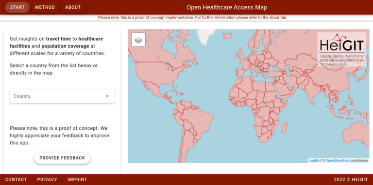
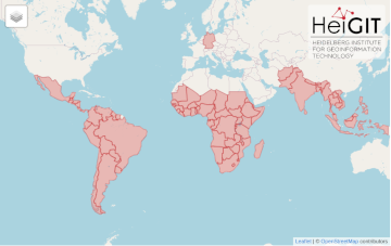
Last year we started the Open Healthcare Access Map. Initially, only a few countries and later on continents were featured. Today, we are pleased to announce that we are…
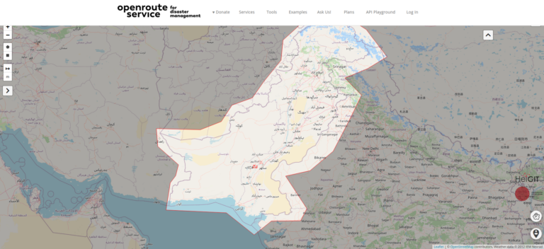
Over the past weeks, monsoon flooding in Pakistan has left over 1,000 dead and millions without homes. As reports and photos of skyrocketing food prices, residents wading through shoulder-deep water,…
UPDATE 09.11.2022: Our team took part in the newly in-person State of the Map 2022 conference in Florence. We attended workshops, talks, and had the opportunity to present our own…
Geoinformatics researchers from Heidelberg are helping to improved the usability of geocoded information through the project “SocialMedia2Traffic”. Heidelberg 23rd of May, 2022. Navigation services require up-to-date traffic information in order…
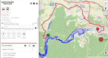
Underpasses, stairs, and high curbsides are a challenge for people with impaired mobility, but these can be circumnavigated using a customized route planner for increasing mobility by calculating routes with…
In the context of the United Nations World Data Forum 2021 organised by theUnited Nations Statistics Division and UN member states a series of blogposts has been published by UNSTATS….
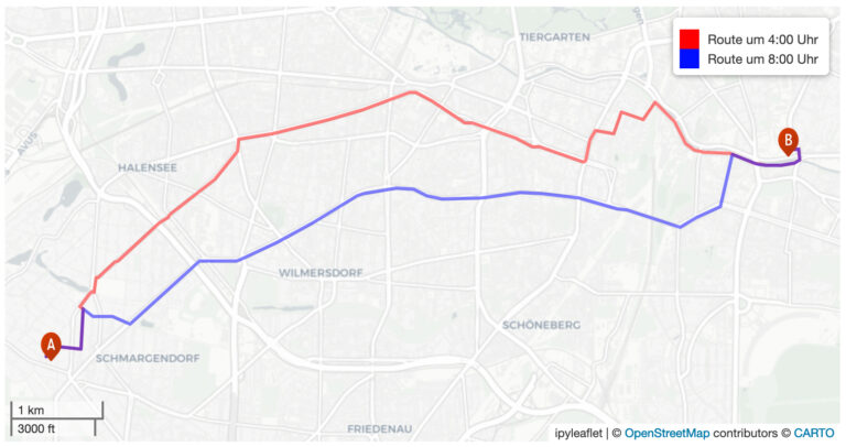
Under pressure from the decision of the Federal Constitutional Court in spring 2021, the German government has amended its climate targets. The new coalition also wants to stick to these…
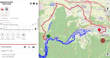
Aktuelle Meldung der Universität Heidelberg zum Projekt HEAL: https://www.uni-heidelberg.de/de/newsroom/wenn-es-in-der-stadt-zu-heiss-wird BADEN-WÜRTTEMBERG STIFTUNG FÖRDERT HEIDELBERGER PROJEKT ZU ROUTINGDIENST MIT HITZEVERMEIDENDEN WEGSTRECKEN Wo in der Stadt Heidelberg ist es besonders heiß und wie…
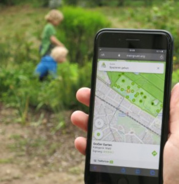
Urban green spaces (UGSs) can provide important ecosystem services for citizens and their well-being. To make use of these services according to UGS user demands, urban residents, tourists, and city…
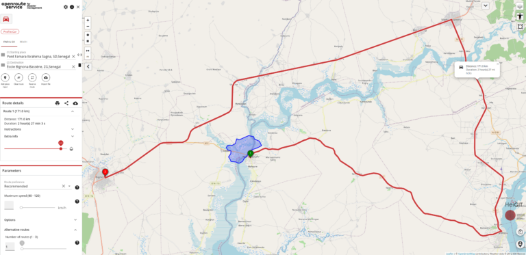
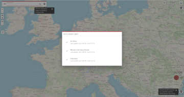
We are happy to announce a revamped openrouteservice maps client for disaster management. It was built based on the new openrouteservice maps client, that is an open source route planner…
The current flooding in Germany has destroyed countless streets or temporarily made them impassable in the affected areas. HeiGIT is working on free and open solutions for humanitarian aid that…
As part of a transdisciplinary collaboration, the Heidelberg Institute for Geoinformation Technology (HeiGIT), the GIScience research group and the TdLab Geography at Heidelberg University are jointly developing adaptation strategies to…
The Regionalverband Ruhr (Team 9-2 Geodata Technology) has used the potential of HeiGIT’s openrouteservice (ORS) in a new QGIS extension and thereby created another possible application for the ORS: The…
The AGILE 2021 conference is taking place this week. It is the the 24rd AGILE conference on GIScience. AGILE is the Association of Geographic Information Laboratories in Europe and the…
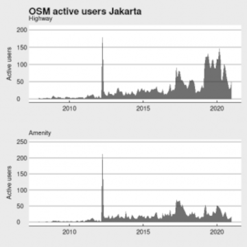
Data quality is an important issue then performing analysis based on OpenStreetMap data. We have recently demonstrated how the effects of the 2013 flood in Jakarta on the accessibility of…
After Sub-Saharan Africa and South and Southeast Asia we have now published all countries of Central and South America on the Open Healthcare Access Map. The web application is available…