This study, published at African Transport Studies, investigates the impact of school sessions on traffic congestion in Nairobi, highlighting how children’s mobility needs are often overlooked in transport planning. The…
Do we really need digital sovereignty—and why? Today, over 80% of Europe’s digital products, services, infrastructures, and intellectual property originate from outside the EU. This dependency affects not only innovation…
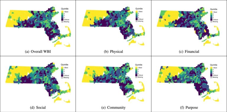
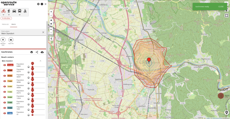
This research shows how spatial indicators from openrouteservice (ORS) can support building-level demographic predictions using machine learning. The study combines ORS APIs, building attributes, and POI data to estimate population…
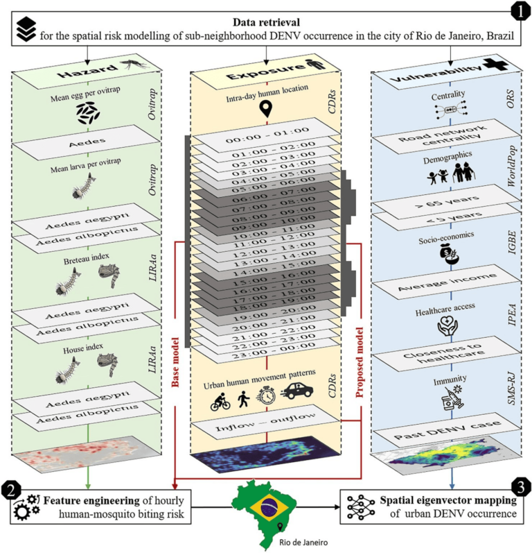
Scientific Reports publishes a paper by Steffen Knoblauch et al. that underscores the critical importance of integrating vector ecology and human behavior into advanced disease modeling frameworks. The increasing availability…
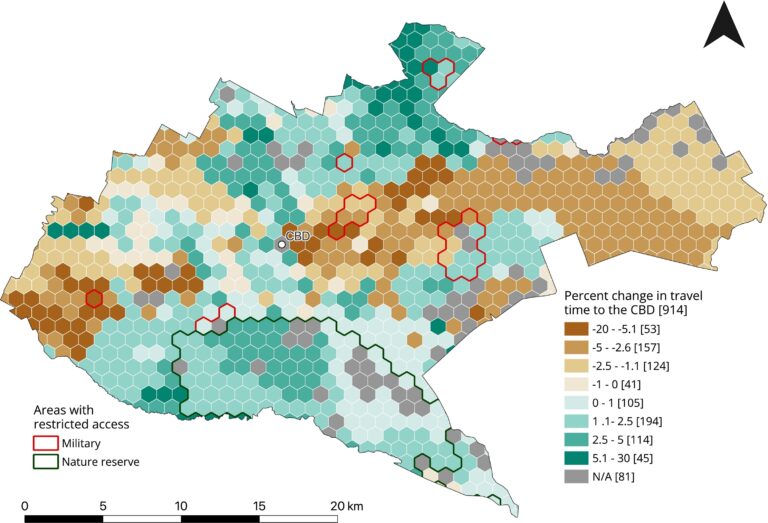
To what extent does crime potentially inhibit geographical access to schools, measured by cumulative average travel time? Education is recognized globally as a fundamental human right and essential for promoting…
HeiGIT has released the 2024 key statistics and numbers of openrouteservice. It demonstrates a significant increase in new users compared to the previous year. Specifically, there has been an increase…
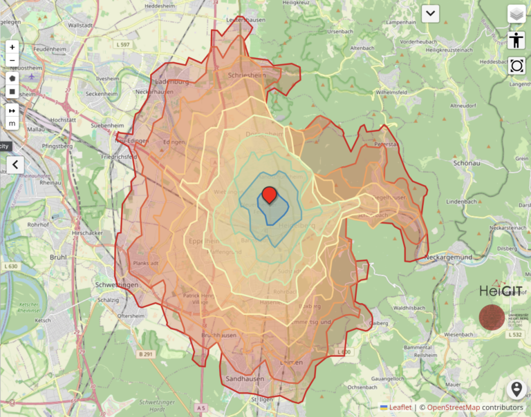
The 15-minute city concept is gaining traction in urban planning, aiming to ensure that essential services are within a short walk or bike ride. As the older population grows, walking…
We are proud to announce the release of openrouteservice version 9.0.0, codename “Europa”. In this release, there are a number of new features that make running your own instance a whole…
The openrouteservice (ORS) continuously evolves, bringing a suite of new features: the export and snap endpoints. These new features will change the way how users interact with and process routing…
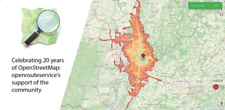
August 9 marks a turning point for the global mapping community: the 20th anniversary of OpenStreetMap (OSM). For two decades, OSM has revolutionized the way we perceive and interact with…
The OpenStreetMap (OSM) and openrouteservice (ORS) provide free geospatial data that serve a multitude of research and practical applications. OSM thrives on its community-driven approach, ensuring its data is always…
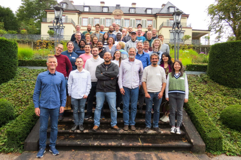
HeiGIT is celebrating its fifth anniversary today, July 1st! To commemorate this occasion, we invite you to join us on a little walk down memory lane….
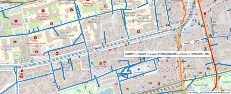
Open-source tools that incorporate open geospatial data, such as openrouteservice (ORS), prove to be beneficial for both academic research and practical applications. These tools enable researchers to pursue innovative approaches…
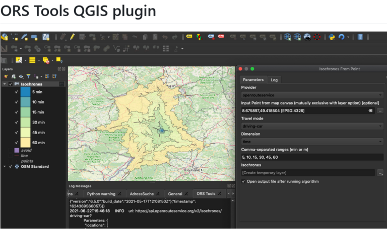
The openrouteservice (ORS) QGIS plugin continues to evolve, bringing a suite of new features, improvements, and fixes that enhance its functionality and user experience. This update incorporates significant changes that…
Free open geodata are of increasing importance. They are used in research or case studies and can lead to important insights on social, economic or environmental topics. A problem that…
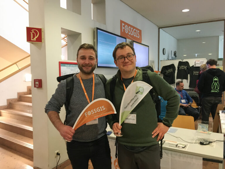
We’re proud to share our recent conference experience with you! Our HeiGIT Product Owners for Big Data and Smart Mobility, @Benjamin Herfort and Julian Psotta, had the privilege of attending…
We’re thrilled to announce the release of openrouteservice (ors) version 8.0, designated “Wilfried”, as a tribute to Prof. Dr. Wilfried Juling, whose steady support and advice fundamentally shaped the growth…
The use of open-source geospatial data, exemplified by services like openrouteservice (ORS), proves to be beneficial for both academic research and use case studies. Witnessing our technologies applied in unanticipated…
Introduction In an era where technology continuously reshapes our world, the fusion of artificial intelligence and geospatial data offers exciting possibilities. HeiGIT (Heidelberg Institute for Geoinformation Technology), a pioneering research…
Just in time for the new year, the openrouteservice team proudly announces the release of v1.7.0 of the ORS Tools QGIS plugin! Quite a lot has happened. First, the GUI…