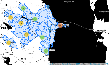
What is the idea behind the Notebook? In the case of an emergency (e.g. floods, earthquakes, political crisis) it is important to know where the health facilities are located. Furthermore, it is important to identify which cities/districts have a reduced … Read More
Deutsch
Optimal ans Ziel: Routing-Dienste auf Basis nutzergenerierter Geodaten
Ein neues Buch gibt in einem Buchkapitel einen Überblick der vielfältigen Aktivitäten von HeiGIT und GIScience im Bereich Routenplanung und Navigation. Neben Grundlagen (wie schnelle Routing-Algorithmen) zur Umsetzung werden vor allem diverse Anwendungsbeispiele für flexible Routing-Dienste in Spezialanwendungen vorgestellt. Hierzu … Read More
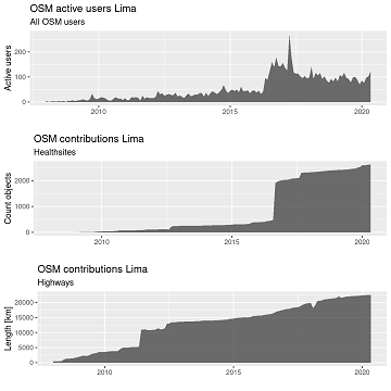
Sucessfull HeiKA autumn school urban data science
The HeiKA autumn school urban data science that took place last week was a good success with participating students varying between five and fifteen during the week. Topics covered included visualization, spatial statistics, analysis of movement data, intrinsic data quality … Read More
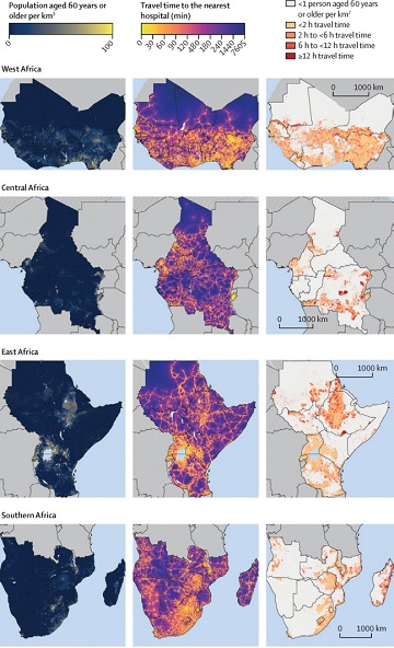
Mapping physical access to health care for older adults in sub-Saharan Africa and implications for the COVID-19 response: a cross-sectional analysis
New paper published on healthcare access in Sub-Saharan Africa It is almost a year since SARS-CoV-2 first emerged in China. The virus spread all over the world. Countries south of the Sahara did not receive much attention. Although outbreaks here … Read More
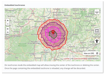
New embedded mode for OpenRouteService map client available
The new openrouteservice map client development is in the final phase and has now a new feature that allows to show routes, isochrones and other features from openrouteservice (ORS) integrated on other websites. This allows webmasters and editors to embed … Read More
Participate in the virtual Copernikus Hackathon 16-17-18 October! HeiGIT contributes with OSM based services
On October 16-18 there is the Copernicus Hackathon “Barcelona” – Integrating Copernicus services and state-of-the-art tools within Weather-induced emergency management HeiGIT is involved in the Copernicus Hackathon by providing free and open web-based services and APIs which leverage OpenStreetMap data … Read More
HeiGIT presentation at MSF GIS Week 2020
This Thursday, team members from HeiGIT will give a presentation at MSF’s Annual GIS Week. This is an internal event at MSF ( Médecins Sans Frontières (MSF) International, Doctors without Borders), which brings together all employees working on GIS and … Read More
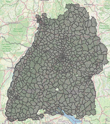
Improved Isochrone Calculation released in openrouteservice v6.3.0
With the release of openrouteservice v6.3.0 at HeiGIT, we are presenting a new and improved speed-up technique that makes it possible to calculate much larger isochrones than with the existing algorithm. An isochrone is an area on the map that … Read More
Disy integriert openrouteservice in Cadenza
Das Karlsruher Softwareunternehmen Disy Informationssysteme GmbH stellt die neue Version der Data-Analytics-, Reporting- und GIS-Plattform “Cadenza” vor. Die Erweiterung der Analytics-Funktionalitäten mit der Bereitstellung einer integrierten Routingfunktion und der POI-Suche sind zwei der wesentlichen Neuerungen. Realisiert wurde das Routing in … Read More

Long Distance Bike and Foot Routing With Restrictions released in ORS Version 6.2.1
After the latest update of openrouteservice to v6.2.1, we are pleased to announce that it is now possible to calculate long distance routes using all bike and pedestrian profiles whilst taking into account of restrictions such as avoiding ferries. Previously, … Read More
Setting maximum speed is back in openrouteservice
Recently openrouteservice has been updated to version 6.2 which has brought some pretty useful features to routing. One of the main “new” features is the re-introducing of the maximum_speed parameter where users can set the maximum speed their vehicle can … Read More
A revamped ORS map client to celebrate the 16th OpenStreetMap anniversary
#OpenStreetMap is turning 16! Happy Birthday from the HeiGIT team. After 16 years OSM is a reference of collaborative work and how we can give our best to create and maintain global, free and multipurpose projects that bring benefits to … Read More
Do you need a shady route because it is too hot?
IT IS REALLY HOT! Again! So it seems, we need to repeat an updated version of a Blogpost from exactly one year ago: You are looking for a more shady pedestrian route through the urban jungle? You might then prefer … Read More

Karlsruhe relies on openrouteservice – ESRI client plugin developed
Since some time the City of Karlsruhe uses the API of Openrouteservice (ORS) by HeiGIT for routing of pedestrians, bicycles and cars in the new online city plan and the citizen GIS app for the general public, i.e. the citizens … Read More
Quiet route planning for pedestrians in traffic noise polluted environments
#Noise #pollution is one of the main stressors in urban environments, having negative impacts on people’s quality of life and health. For some groups of citizens, such as school children, patients, and elders, there is a need to support them … Read More
Physische Erreichbarkeiten von Krankenhäusern in Subsahara Afrika – Analyse und Ergebnisse bei COVID-19 Symposium vorgestellt
Vom 06. bis zum 08. Juli fand das Online Symposiums “COVID-19 als Zäsur? Geographische Perspektiven auf Räume, Gesellschaften und Technologien in der Pandemie” statt. Teilnehmer aus Geographie, Medizin, Public health und meidizinischer Geographie diskutierten über drei Tage in sechs verschiedenen … Read More

meinGrün Schnitzeljagd in Heidelberg gestartet
Wo befindet sich dieser Spielplatz in Heidelberg? Wie komme ich zum nächst gelegenden Park und das möglichst auf einer Route mit viel Grün oder wenig Lärm? Wer das herausfinden möchte, sollte an der meinGrün Schnitzeljagd teilnehmen. Nachdem die Schnitzeljagd in … Read More

HeiGIT gGmbH is One Year Old Today!
Today (1st July 2020) marks the first birthday of HeiGIT gGmbH! Over this first year, HeiGIT has been involved a large number of events, projects, publications, and press coverage. Founded on the 1st July 2019, HeiGIT is a non-for-profit organisation … Read More

Exploring OSM for healthcare access analysis in Sub-Saharan Africa
Using hospital locations and the ORS Isochrone service, we have created a method for comparing physical access to healthcare in Sub-Saharan Africa. Hospital locations were derived from OpenStreetMap and compared against another free available dataset. Results indicate strong similarity in … Read More
Going green with MeinGrün – Today App launch in Heidelberg and Dresden
Today the time has come: The “meinGrün” web app for Dresden and Heidelberg is officially launched. With the mobile application you can (re-)discover known and unknown green spaces and find a pleasant route to those. Users can learn about the … Read More

