Big news from the ohsome team: the release 1.0 of one of our major services, the ohsome API for ohsome OpenStreetMap History Analytics, is on the doorstep. We are bringing three major advancements along with this version. The first one … Read More
Deutsch
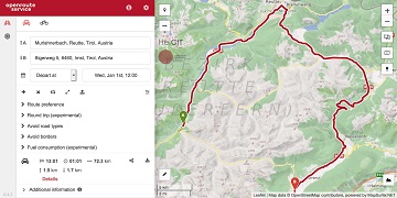
Advanced time-dependent routing soon available in Openrouteservice
We are thrilled to give you a sneak peak into routing with time-dependent road restrictions, the outcome of our collaboration with GraphHopper GmbH in the research project TARDUR supported by the mFUND initiative of the Federal Ministry of Transport and … Read More
25 Jahre Klaus Tschira Stiftung: KTS fördert zum Jubiläum zahlreiche 25er Aktionen – HeiGIT mit 25 Mapathons dabei
25 Jahre Klaus Tschira Stiftung: KTS fördert zum Jubiläum zahlreiche 25er Aktionen – HeiGIT mit 25 Mapathons dabei In diesem Jahr wird die Klaus Tschira Stiftung (KTS) 25 Jahre alt. Zu ihrem Jubiläum hat sich die Stiftung eine ganze Reihe … Read More

GIScience Contributions to the 2019 State of the Map Academic Track proceedings
Recently the SOTM 2019 Heidelberg Academic Track Proceedings have been published. GIScience Research Group Heidelberg and HeiGIT contributed several talks and posters. Below you can find an overview. Contact us if you are interested in further details on ongoing research. … Read More
5 Years Missing Maps- Achievements and future work and how to visualize the Missing Maps impact using ohsome
Happy Birthday Missing Maps! On the occasion of the recently launched Missing Maps 5 Years Birthday Blog, that also highlighted our latest Missing Maps related HeiGIT and ohsome projects, we put together an overview of our years with and within … Read More
Standortübergreifender Mapathon im Rahmen der Geography Awareness Week
im Rahmen der Geography Awareness Week laden die Geographie-Fachschaften der Standorte Göttingen, Hannover, Würzburg und Heidelberg und die disastermappers heidelberg herzlich zum standortübergreifenden Mapathon ein! An diesem Mapathon werden wir gemeinschaftlich mit Hilfe von OpenStreetMap und fernerkundlichen Methoden neue Kartendaten … Read More
Winner of the 2019 Climathon Heidelberg
Over the last few days, Heidelberg’s first climathon event took place at EMBL, which was part of the global Climathon. The event ran from 25th-27th October 2019 with a 24 hour hackathon taking place on the 26th-27th. During the 24 … Read More

Viele Daten- Welcher Nutzen? HeiGIT Workshop mit BBK und DLR bei der Fachtagung Katastrophenvorsorge 2019
Am 28. und 29. Oktober findet in Berlin die jährliche Fachtagung Katastrophenvorsorge statt. In diesem Rahmen treffen sich erneut Expertinnen und Experten aus dem (inter) nationalen Katastrophenmanagement um sich zu neuesten Entwicklungen, Ideen und auch Herausforderungen in der Katastrophenvorsorge auszutauschen- … Read More
Brownbag Presentation by Jennings Anderson (University of Colorado Boulder) on OpenStreetMap data analysis
We cordially invite you to a Brownbag presentation by our Guest Researcher Dr. Jennings Anderson! When? Tuesday, 8/10/2019, 1-2.30 pm Where? Seminar room 15, INF 348 Jennings is a postdoctoral researcher at the University of Colorado Boulder exploring new approaches … Read More
State of the Map and HOT Summit in Heidelberg
SotM Image by Thomas Skowron, licensed under CC BY 2.0 Over the last few days, Heidelberg has been host to the annual HOT Summit and State of the Map conference with a combined attendance of over 800 people. The HOT … Read More
OpenStreetMap, eine stille und nützliche digitale Revolution
Über 500 Mitgestalter des ehrenamtlich erstellten Kartenwerks treffen sich in Heidelberg. Ihr Motto: „Freie Projekte benötigen freie Daten“ Verkehrsminister Winfried Hermann: „Nachhaltige Mobilität und frei verfügbare Daten passen sehr gut zusammen“ Ein besonderes Beispiel der digitalen Mitgestaltung ist die OpenStreetMap … Read More
Pressekonferenz: State of the Map, Heidelberg 21.09.2019
Presseeinladung 18.09.2019 (PDF Link hier) Weltkonferenz für eine Freie Karte Die Macher von OpenStreetMap treffen sich in Heidelberg Universität Heidelberg und Verkehrsministerium Baden-Württemberg unterstützen Initiative Sehr geehrte Damen und Herren, hochwertiges digitales Kartenmaterial muss nicht kommerziell sein. Seit mittlerweile 15 … Read More
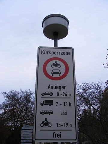
Interested in time-dependent routing?
We are delighted to invite you to join a workshop on open-source routing with time-dependent restrictions, see http://giscienceblog.uni-hd.de/2019/04/17/project-tardur-starts-open-source-routing-with-time-dependent-restrictions/. The workshop is taking place on Friday before the State of the Map conference, 20th September 2019 in Heidelberg. It is free … Read More
The potential of Open Geospatial Data to address the Sustainable Development Goals- Geospatial World Magazine Article on how HOT and HeiGIT are supporting current approaches
Geospatial data is key for empowering citizens around the globe and to achieve the SDGs— if geodata is made openly available and easy to be put to use. The Humanitarian OpenStreetMap Team (HOT) is in this regard coordinating and supporting … Read More
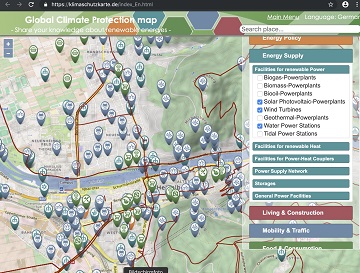
Support the global OSM Climate Protection Map at WorldEnvironmentDay
Today, June 5 is the #WorldEnvironmentDay. World Environment Day is the United Nations day for encouraging worldwide awareness and action to protect our #environment. Above all, World Environment Day is the “people’s day” for doing something to take care of … Read More
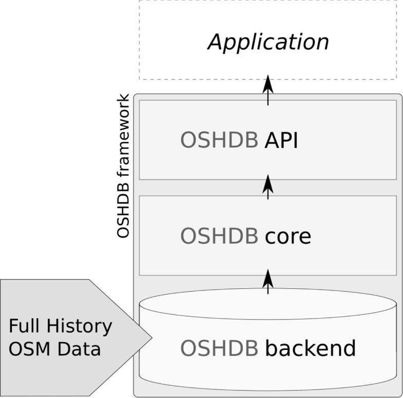
OSHDB: a framework for spatio-temporal analysis of OpenStreetMap history data
Earlier we published several blogposts introducing the ohsome platform and its parts (e.g. the ohsome API for example, which was often showcased here in the blog) and its backbone the OSHDB (very recently version 0.5 was published). A recent open … Read More
GIScience / HeiGIT at ICT for Development, Kampala – Usage and Analyses of OpenStreetMap for Development
The 11th Information Communications Technology for Development (ICT4D) Conference brings together hundreds of public, private and civil society organizations, eager to share practical insights on applying digital technology to development, humanitarian, and conservation challenges. Participants share how they are using … Read More
Project “TARDUR” starts: Open-source routing with time-dependent restrictions
Time-dependent restrictions and temporal road closures are so far not considered in any freely available software for route planning. Heidelberg University and the company GraphHopper aim to address this issue in their joint project “TARDUR – Temporal Access Restrictions for … Read More
OpenStreetMap History Database – version 0.5
The OpenStreetMap History Database (OSHDB) is what powers most of the functionality of HeiGIT’s ohsome platform. The ohsome API for example, which was often showcased here in the blog, is built on top of the OSHDB. Just recently, an open … Read More
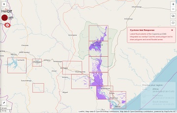
openrouteservice for Disaster Management: Response to Cyclone Idai
The Humanitarian OpenStreetMap Team (HOT) has launched an activation to support humanitarian operations responding to the impact of Cyclone Idai. These efforts were already supported by more than 1500 mappers of the global OpenStreetMap (OSM) community that contribute geodata about … Read More
