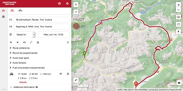
We are thrilled to give you a sneak peak into routing with time-dependent road restrictions, the outcome of our collaboration with GraphHopper GmbH in the research project TARDUR supported by the mFUND initiative of the Federal Ministry of Transport and … Read More
Deutsch
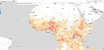
Analysing OSM Completeness of health facilities in Sub-Sahara Africa in ohsomeHeX
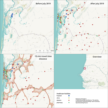
A new map in ohsomeHeX provides an overview of areas in Sub-Sahara Africa where information on health facilities is still missing in OpenStreetMap (OSM). The completeness of OSM is measured by comparing to a reference dataset on public health facilities … Read More
Quota for Openrouteservice multi vehicle optimization increased to support logistics during Corona crisis
Supplying medicine and food is critical not only in disasters. Due to increased global demand due to COVIDー19 HeiGIT increased the API quota for the Openrouteservice multi vehicle route optimization endpoint! Now you can send up to 500 requests per … Read More
25 Jahre Klaus Tschira Stiftung: KTS fördert zum Jubiläum zahlreiche 25er Aktionen – HeiGIT mit 25 Mapathons dabei
25 Jahre Klaus Tschira Stiftung: KTS fördert zum Jubiläum zahlreiche 25er Aktionen – HeiGIT mit 25 Mapathons dabei In diesem Jahr wird die Klaus Tschira Stiftung (KTS) 25 Jahre alt. Zu ihrem Jubiläum hat sich die Stiftung eine ganze Reihe … Read More
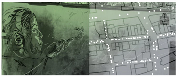
ISPRS IJGI highlights our work on deep learning of Street Art from VGI and Street View Images
We are pleased to share that because of the response to our work, ISPRS IJGI selected our paper on Detecting Graffiti with Street View Images and Deep Learning to be highlighted as a title story through some graphics on the … Read More

MapSwipe wins Global Mobile Award for the Best Mobile Innovation Supporting Emergency or Humanitarian Situations
This week, at the prestigious GSMA MWC series (formally known as Mobile World Congress) MapSwipe was awarded the top prize in the Global Mobile Awards’ category for the Best Mobile Innovation Supporting Emergency or Humanitarian Situations. The award recognizes how … Read More
Volunteered Geographic Information research in the first decade: a narrative review of selected journal articles in GIScience
More than 10 years have passed since the coining of the term volunteered geographic information (VGI) in 2007. A recently published article presents the results of a review of the literature concerning VGI. A total of 346 articles published in … Read More
Colloquium Talk about healthsites.io: Building a baseline of health facility data in OpenStreetMap by M. Herringer
We are happy to invited to the presentation in the GIScience HD colloquium. Everybody interested is invited to join the presentations and the discussion afterwards. Building a baseline of health facility data in OpenStreetMap Markus Herringer, healthsites.io, Amsterdam, NL – … Read More

Detecting OSM Building Facades with Graffiti Artwork Based on Street View Images and Social Media using Deep Learning
As a recognized type of art, graffiti is a cultural asset and an important aspect of a city’s aesthetics. As such, graffiti is associated with social and commercial vibrancy and is known to attract tourists. However, positional uncertainty and incompleteness … Read More

GIScience Contributions to the 2019 State of the Map Academic Track proceedings
Recently the SOTM 2019 Heidelberg Academic Track Proceedings have been published. GIScience Research Group Heidelberg and HeiGIT contributed several talks and posters. Below you can find an overview. Contact us if you are interested in further details on ongoing research. … Read More
ohsome presentation in Malta at the 3rd International Workshop on Spatial Data Quality
Around 55 participants gathered in Malta for the 3rd International Workshop on Spatial Data Quality 2020 from 28th to 29th of January. Among national mapping agencies, software providers and standardization organizations, HeiGIT had the opportunity to present its ohsome – … Read More
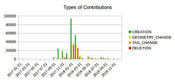
Mapping Rohingya Refugee Camps in Bangladesh – An Analysis Using the OSHDB API
Humanitarian mapping activations show increasing numbers of contribution. This blog post illustrates the specific potential of the OSHDB API [1] for detailed analyses of such activations by means of a case study. The examined area is Cox’s Bazar in Southeast … Read More

Urban flooding in Handschuhsheim – Using User-Generated Geographic Data in Flood Risk Management
A week ago, students from the seminar “User-Generated Geographic Data in Disaster Risk Management and Humanitarian Aid” carried out a survey about urban flood risk in Handschuhsheim. The “field day” was organised by Carolin Klonner and Melanie Eckle (the teachers … Read More
Healthsites and HeiGIT establish partnership
The Global Healthsites Mapping Project (Healthsites) and the Heidelberg Institute for Geoinformation Technology/ GIScience Research Group are happy to announce the now also formal cooperation. Last week, HeiGIT/ GISciences signed the Healthsites Memorandum of Understanding (MoU) to strengthen their strategic … Read More
Becoming ohsome is simple: Adding support of simple feature types to the ohsome API
It’s been a while, since we have published the last blog post about the awesome ohsome platform, but don’t worry, there’s always something happening of course in the spatial analytics team of HeiGIT. So here we are, back on track … Read More
GeoNet.MRN at Smart City Expo World Congress Barcelona 2019
Last week was the Smart City Expo World Congress 2019 took place in Barcelona. Our region geoinformation network GeoNet.MRN was there with a booth presenting the members of GeoNet.MRN, among others the GIScience Research Group / HeiGIT at Heidelberg University. … Read More
Marcel Reinmuth: Talk about internship at Humanitarian OpenStreetMap Team Uganda
GIScience HD/HeiGIT sind seit geraumer Zeit Partner des Humanitarian Open StreetMap Team (HOT) und arbeiten an gemeinsamen Projekten zur Verbesserung von Geoinformationstechnologien und der Verfügbarkeit von Geodaten (insb. OpenStreetMap) für humanitäre Einsätze, insbesondere im globalen Süden, z.B. über die Missing … Read More
Standortübergreifender Mapathon im Rahmen der Geography Awareness Week
im Rahmen der Geography Awareness Week laden die Geographie-Fachschaften der Standorte Göttingen, Hannover, Würzburg und Heidelberg und die disastermappers heidelberg herzlich zum standortübergreifenden Mapathon ein! An diesem Mapathon werden wir gemeinschaftlich mit Hilfe von OpenStreetMap und fernerkundlichen Methoden neue Kartendaten … Read More
Winner of the 2019 Climathon Heidelberg
Over the last few days, Heidelberg’s first climathon event took place at EMBL, which was part of the global Climathon. The event ran from 25th-27th October 2019 with a 24 hour hackathon taking place on the 26th-27th. During the 24 … Read More

Einladung zum Beta Test der meinGrün App
Beim Konsortialtreffen letzte Woche haben wir die erste Beta Version der meinGrün App fertiggestellt. Jetzt benötigen wir Grünflächen-Enthusiasten, die mit uns zusammen die App testen, um sie weiter zu verbessern. Diesen Samstag findet unser erstes Test-Event statt: WO: Volkshochschule Heidelberg … Read More

