Sketch Map Tool (SMT) – An easy-to-use way to create and digitalize paper maps for offline data collection in the field The HeiGIT (Heidelberg Institute for Geoinformation Technology) team recently…
Last week, HeiGIT team member Anne Schauß held a workshop session in Kuala Lumpur, Malaysia, during a training of the International Federation of Red Cross and Red Crescent Societies (IFRC)….
The UndercoverEisAgenten team have developed a new online mapping application to monitor permafrost thaw. From now on, interested citizen scientists can directly contribute online to collect reliable and up-to-date data…
During catastrophic events such as the recent Türkiye/Syria earthquake, the road infrastructure in the affected area is often widely interrupted and accessibility varies over time. In spite of this, it…
The German Red Cross (GRC) has been working with the Heidelberg Institute for Geoinformation Technology (HeiGIT gGmbH) and the German Aerospace Center (DLR) for several years to bridge the gap…
Last Wednesday we were excited to present the new version of the Sketch Map Tool in an online launch event! We thank all participants for joining and for their feedback…
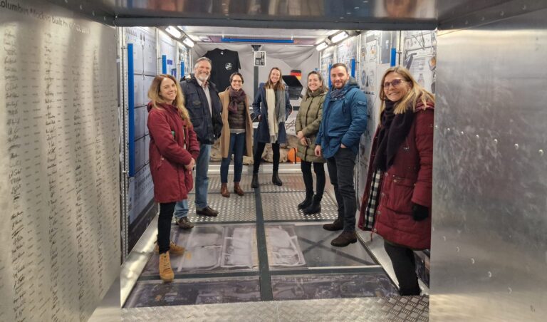
Cover image: Team representatives from German Red Cross, DRL and HeiGIT in the replica of the European research capsule COLUMBUS, which is part of the International Space Station (ISS). Photo…
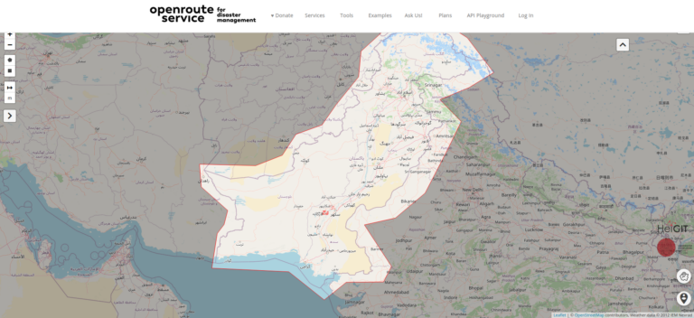
On February 6, a 7.7 magnitude earthquake struck southern Türkiye at 4:17 a.m. This is Türkiye’s most powerful earthquake recorded since 1939. The Government of Türkiye has since issued a…
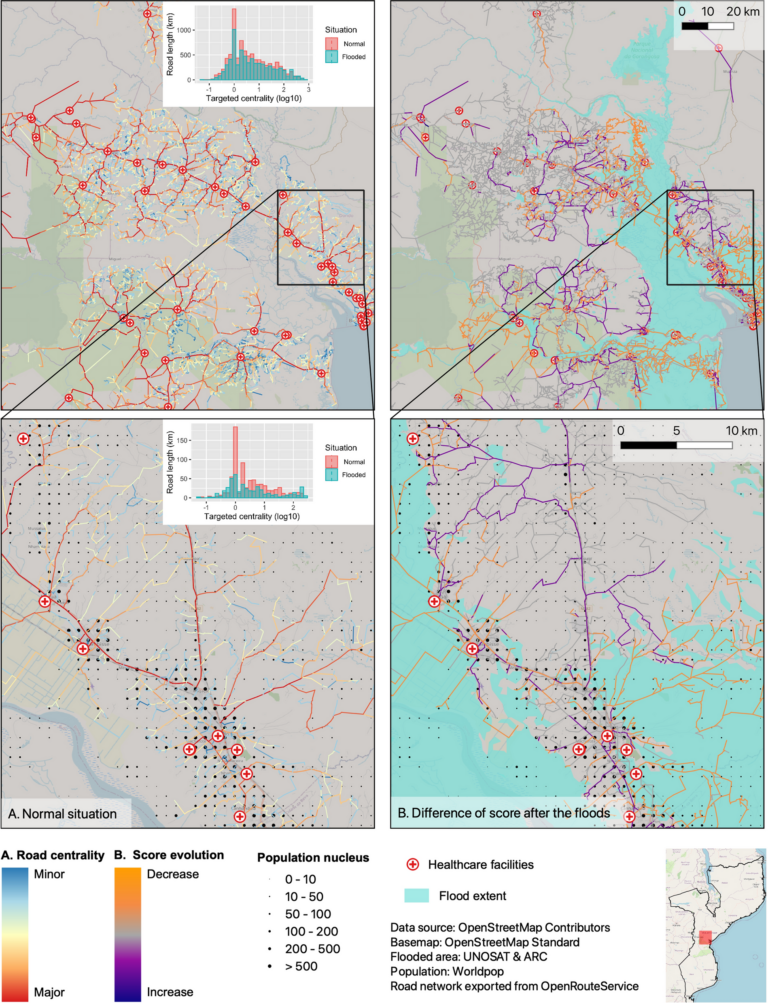
Centrality indicators are used to identify important nodes or edges in graph networks. Applied to road networks these indicators can for example be used to model traffic speed or identify…
Volume 26, Issue 8 of Transactions in GIS, published in December 2022, has a cover story and it’s us- well, our article anyway. Besides uniting our love of math, mapping,…
Featured Image: Road network analysis for the driving profiles. A Normal conditions before the flood event. B Evolution of scores after the floods induced by Cyclone Idai. The lower row…
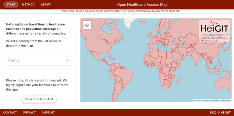
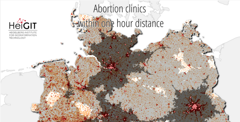
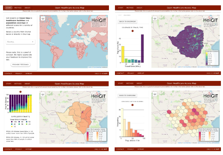
Last year we started the Open Healthcare Access Map. Initially, only a few countries and later on continents were featured. Today, we are pleased to announce that we are…
Over the past weeks, monsoon flooding in Pakistan has left over 1,000 dead and millions without homes. As reports and photos of skyrocketing food prices, residents wading through shoulder-deep water,…
UPDATE 09.11.2022: Our team took part in the newly in-person State of the Map 2022 conference in Florence. We attended workshops, talks, and had the opportunity to present our own…
From our team, Benjamin Herfort and Marcel Reinmuth participated in sessions, offered a hands-on workshop concerning accessibility analysis, and facilitated a discussion round on participatory mapping….
Underpasses, stairs, and high curbsides are a challenge for people with impaired mobility, but these can be circumnavigated using a customized route planner for increasing mobility by calculating routes with…
The project UndercoverEisAgenten aims to gather reliable and up-to-date data on the thawing of the permafrost in collaboration with citizen scientists. The project invites citizens from Germany and Canada to…
Just a couple of days ago, on December 16th, large area of the Philippines were hit by Typhoon Rai (local name Odette). The typhoon not only caused vast destruction but…
In the context of the United Nations World Data Forum 2021 organised by theUnited Nations Statistics Division and UN member states a series of blogposts has been published by UNSTATS….